The UK is facing a north/south split this week with parts of the country bracing themselves for another scorching spell after a brief respite from the heatwave over the weekend.
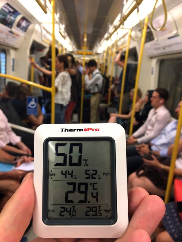
While sun worshippers will reduce, those facing sweaty commutes will probably wish they lived at the other end of the country as the heatwave returns with a vengeance.
Weather forecasters have warned that the mercury is likely to hit 30C (86F) across the south of England by Friday, instead of being concentrated in the south east.
The thermometer will carry on climbing over the weekend reaching highs of 32C (89.6F) and possibly 33C (91.4F).
While the south shrivels, northern parts of the UK will continue to see showers with temperatures sitting in the mid 20s.
It comes as latest analysis shows 20% more rain is falling every year compared to the three decades leading up to 1990.
A spokeswoman for the Met Office said: “In terms of the weekend just gone, they were the first two days this month where temperatures haven’t reached 25C (77F) but we have got back to that point today, it hit 25.3C (77.5F) in Cavendish in Suffolk so it’s already starting to warm up again.
“Over the next few days there will be something of a north and south split – high pressure is already starting to build up in the south, bringing dry, fine and weather.”
She warned: “Southern England and Wales are going to turn quite hot by Friday – temperatures will probably reach 30C (86F) by that point.
“This is likely to include quite a wide area across the southern part of the UK – it will widely hit 30C (86F) across southern England and Wales, and the very hot weather will return as we approach the weekend.”
The north of England, Scotland and Northern Ireland can expect outbreaks of much-needed rain on Tuesday, Wednesday and in to Thursday.

The spokeswoman said: “It’s a more varied picture across the north but it’s an improving situation – sunshine with some showers and a similar story across the weekend.
“By Friday the temperatures could get into the mid 20s, so warming up, just not as hot as it is in the south.”
The weather broke on Friday, treating the parched landscape to a deluge of rain.
It meant this July will be wetter than the blistering heatwave of July 1976.
An average 49.9mm of rain fell across the UK from July 1 to July 29, according to provisional figures from the Met Office, and with further rain expected this week, the final total could be higher.
The total for the whole of July 1976 was 43.3mm.
The UK suffered a long heatwave during the summer of 1976, which helped make July 1976 the joint ninth driest on record.
Currently, July this year is the 13th driest on record, the Met Office said.
The driest ever July was in 1955, when an average of 30.6mm rainfall was measured across the UK. Comparable records for rainfall date back to 1910.
According to the forecaster’s annual State of the UK Climate report, released on Tuesday, last year was the fifth warmest on record despite a wet summer and several cold spells in the winter.
The study shows average temperatures over the past decade have risen by about 0.8C compared to the 30-year period to 1990, but it does not take into account this year’s two-month dry heatwave.