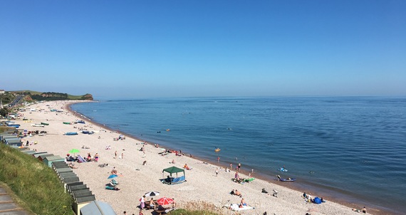
On 21 June 2017, the thermometer at Heathrow recorded a sweltering 34.5 °C. This was the peak of the longest continuous June hot spell since the glorious summer of 1976. Every day for five days, somewhere in the UK exceeded 30 °C. Thunderstorms brought the heat to a spectacular conclusion on 21 and 22 June with flooding in North East England and lightning disruption in Kent, London and Leicestershire.
Perhaps most remarkable was that the longest June hot spell for 41 years only lasted five days. In our changeable climate, long summers like 1976 are rare. In fact, King George II apparently summed up British summers as three fine days and a thunderstorm. If fine weather in the Mediterranean lasts for months, why do rising temperatures in the UK often end in a bang?
George may not have realised the short-lived British summer is often the result of a Spanish Plume, a specific sequence of events beginning with Iberian heat and ending in British thunderstorms. We now know his three fine days start with high pressure close to the UK. This blocks Atlantic rain clouds and brings several days of strong sunshine to Western Europe, especially over the Iberian Peninsula.
Meanwhile, European high pressure re-directs low pressure in the Atlantic south, often towards the Bay of Biscay. This low lifts the intensifying heat over the Spanish plateau, drawing it north to the UK. The blistering Iberian air rises further still and can be ten thousand feet high when it arrives above the British Isles. Hot air acts then like a lid, preventing humid air near the ground from escaping. Temperatures climb daily in a situation meteorologists describe as potentially unstable. It’s only a matter of time before it goes bang.
Eventually, the same Atlantic low responsible for bringing Spanish heat to the UK causes its demise. Low pressure carries a cold front, providing a big difference between European heat and Atlantic cool air. Strong winds, high in the sky, cause cold air to spill first into the upper reaches of the atmosphere above northwest Europe. Thousands of feet below, trapped air over the UK warms enough to break through the lid of hot Spanish air. Aided by falling pressure and rising air ahead of the advancing Atlantic low, rapidly rising humid air over the UK cools and condenses into cumulonimbus storm clouds as it encounters the cold air above.
Results can be spectacular as energy is released through thunderstorms. Devastating impacts can be caused by intense downpours, lightning, hail and even tornadoes.
Over a century after the reign of George II, another British monarch was caught out by the British summer. On a scorching June day in 1897, thunderstorms disrupted Queen Victoria’s Diamond Jubilee. As the mercury soared to 32°C at Brixton, thunderstorms across London and gusty winds swept away Jubilee decorations, fetes and even a marquee at Wembley Park. Hail measuring 6cm across fell above Essex and two men were killed by lightning in Norwich.
More recently, Spain had its hottest day on record – a staggering 47.3 °C at Montoro on 13 July 2017. Less than a week later, a Spanish Plume hit the UK. Marble-sized hail and a torrent of water flooded the Cornish village of Coverack. Thankfully, no one was seriously harmed. However, Met Office research suggests that in a warming world, the risk of extreme downpours will increase during the coming decades.
While British summers may still be described as three fine days and a thunderstorm, it’s more important than ever that we understand the mechanisms that cause the UK’s hottest weather to be followed by its most violent thunderstorms.
— This feed and its contents are the property of The Huffington Post UK, and use is subject to our terms. It may be used for personal consumption, but may not be distributed on a website.
