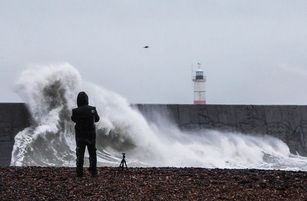
Storm Erik’s strong winds will bring another blustery day to the UK, before snow showers hit some parts.
Gusts of 70mph are expected on Saturday, as Erik batters much of the country for a second day.
The storm’s strongest recorded gust on Friday was 84 mph at Capel Curig, in Wales, the Met Office said.

Footage showed a British Airways plane forced to abandon its initial landing at Heathrow airport after strong winds put the aircraft off-balance seconds before it was about to touch down.
Also on Friday a tree fell on to a double-decker bus in Dorset, but no injuries were reported.

A weather warning for wind on Saturday has been extended to cover most of the UK, while in Scotland heavy rain is expected into the afternoon, with a risk of flooding in some parts, the Met Office said.
Much of the country will see strong winds and rain showers, some mixed with hale and becoming thundery, meteorologist Alex Burkill said.
“It’s going to be another very windy one, particularly across northern England, Northern Ireland, southern Scotland and northern Wales. They’re going to have very strong winds.
“We could therefore see some further problems on roads.”
As winds ease off later on Saturday, some hill snow is forecast in central and southern parts of England and into Wales, Mr Burkill said, before calmer conditions on Sunday.
“That (hill snow) will clear through Sunday morning, with blustery showers following behind. Meanwhile, in the north it’s going to be a fairly bright day. There will be a few showers perhaps and it could turn windy but not as windy as today by any means.”