Storm Caroline deposited up to 10cm of snow on parts of Britain overnight as temperatures dropped to a bone-chilling -3.8C in the Scottish borders.
Bingley in west Yorkshire saw 4cm of snow, as did Leek in Staffordshire. Aviemore in Scotland recorded 7cm while a wintry 10cm fell in Londonderry.
Friday will see fine and bright conditions across the east of the country, but though temperatures will reach 4C in London and 2C in Hull, the wind chill factor means it will feel much, much colder. “It won’t necessarily be a surprise if we have a few snowflakes in London today, though nothing will settle,” a spokesman for the Met Office said.
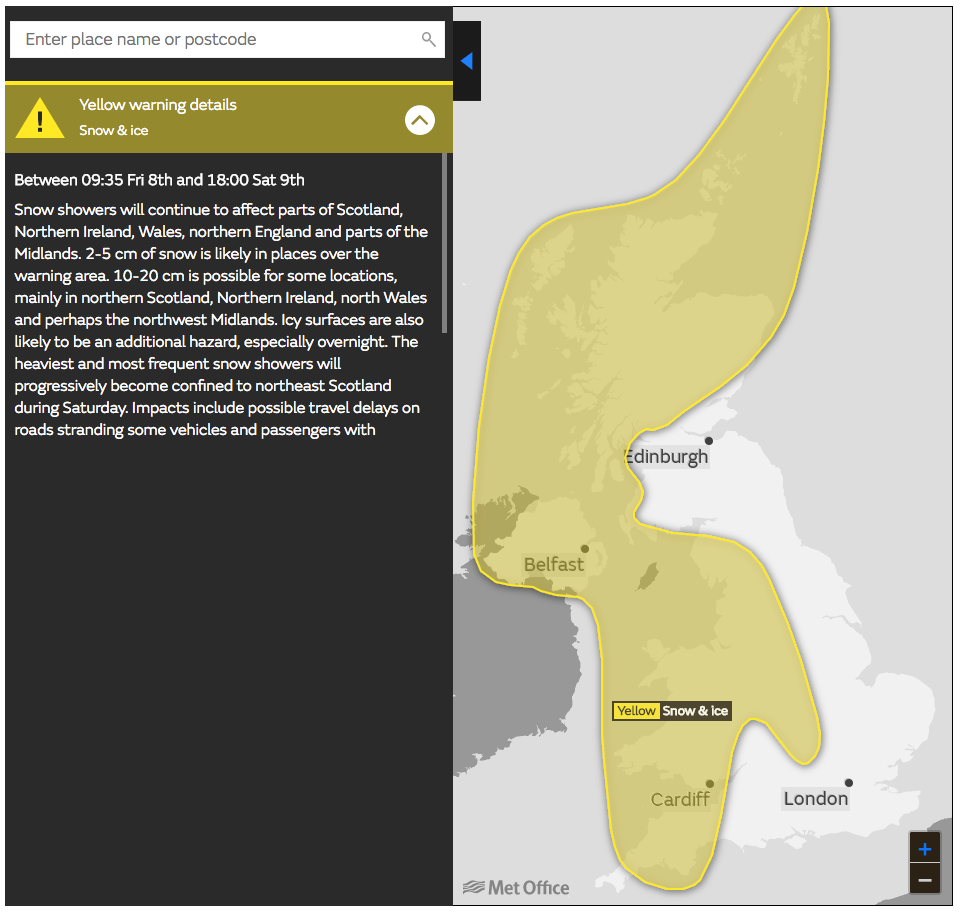
For the west, Northern Ireland, Wales and northern Scotland, it will be cloudier with sunny spells and further snow thanks to wintry showers and a yellow weather warning for snow and ice is in place until 6pm on Saturday.
Friday night will be very cold thanks to a northerly wind, with the mercury dropping to between -2 and -5 broadly, and down to -10 in places where snow has remained overnight.
Saturday will feel brighter and calmer, with less wind and it will be substantially milder in the south east, though snow showers are expected in Manchester and Northern Ireland.
Leeds and Hull will see temperatures of 2C, climbing to 4C in London.
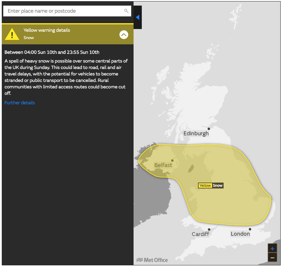
Come Sunday, the weather will become much more unsettled with heavy rains expected in Devon and Cornwall, eventually moving westwards and falling as snow over Wales, central and northern parts of England, where a yellow snow alert is active. Broadly speaking, affected areas could see up to 5cm, though it could be up to 10cm in places. Scotland will be brighter and more settled, though showers are forecast in the far north.