“Good afternoon to you. Earlier on today apparently, a woman rang the BBC and said she heard there was a hurricane on the way. Well, if you’re watching don’t worry, there isn’t…”
That night, the British Isles was hit by its worst storm since 1703. 22 lives were lost across Britain and France. Hundreds of thousands of homes were left without power, with destructive winds bringing down 15 million trees and blocking many roads and railways with wreckage. The cost of devastation from the Great Storm rose to £1 billion.
Strictly speaking, Mr Fish was correct: The Great Storm wasn’t technically a hurricane. Hurricanes, by definition, are tropical cyclones fuelled by seas warmer than 26 °C. This was an extratropical cyclone – otherwise known as a mid-latitude depression. The main differences are to do with where they form, how they are fuelled and their structure.
For those hit by the Great Storm, these technical differences won’t matter. The Great Storm was as terrifying and – with sustained wind speeds near Eastbourne of 87 mph – as powerful as a category one hurricane.

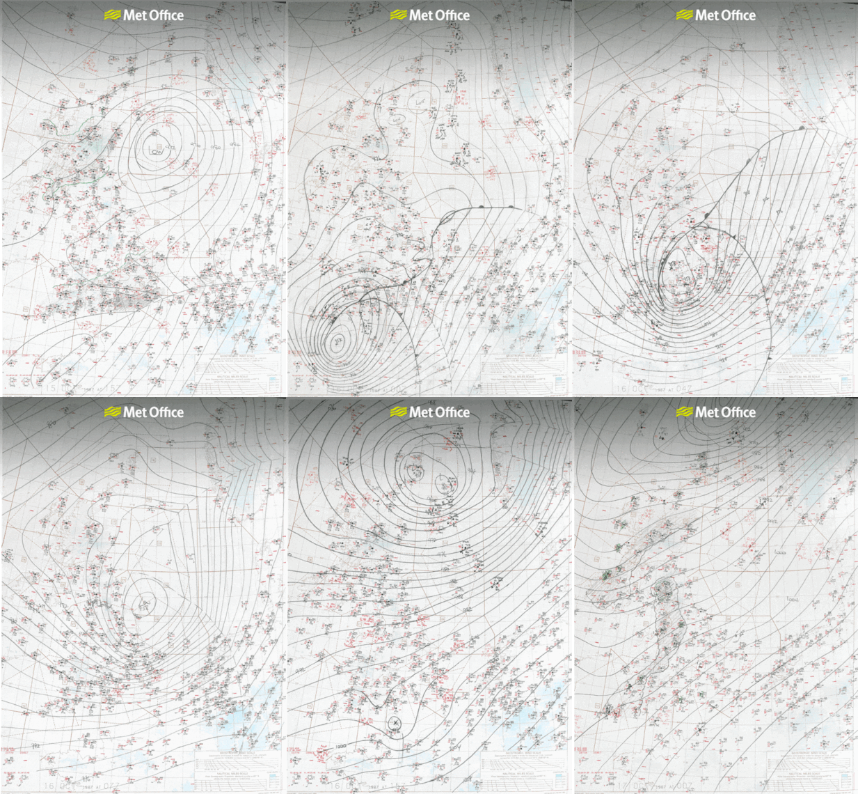
The original hand-drawn charts from the 15th and 16th October 1987. Credit: Met Office.
Incredibly, the public were not warned of what was to come – even in the hours before it struck. Nowadays, we have instant access to weather forecasts online and through our mobile apps as well as continuous updates via social media. It’s difficult to imagine going to bed in the evening completely unaware of an imminent hurricane-force storm in the English Channel. But would we really do a better job in 2017 compared to 1987?
A comparison of the technological progress between 1987 and 2017 demonstrates just how far we’ve come during the past three decades. In 1987 the Met Office supercomputer could only perform 4 million calculations per second. Modern smartphones can perform around a thousand times that number of instructions per second.
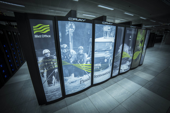
Of course, these are dubious comparisons; smartphones are not designed to run computer weather prediction models. But 2017’s weather computers are billions of times more powerful than 1987’s. The current Met Office Cray XC40 computer can run a mind-boggling 14 thousand trillion calculations per second, equivalent to 2 million calculations every second for every human on the planet.

Met Office supercomputer. Credit: Met Office.
Powerful supercomputers can handle more data. One failing in 1987 was the lack of weather observations – just 1200 – to represent the current weather across the whole planet. If we don’t know the current state of the atmosphere, how can we accurately predict its future state? In 2017, 215 million weather observations are fed into the supercomputer with the majority of these arriving from satellites allowing an uninterrupted view of the entire world.
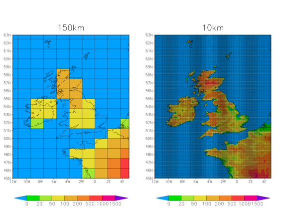
To turn weather observations into reliable forecasts, the Met Office runs high-resolution computer models. In 1987, the resolution for the Met Office ‘coarse grid mesh’ global model was 150 km with a so-called ‘fine grid mesh’ at 80 km resolution covering the North Atlantic and Europe. Now, the global model is 10 km and the UK is covered by a 1.5 km grid.

Credit: Met Office. A comparison of the global computer model resolution in 1987 and 2017.
Perhaps most importantly, in modern weather forecasting the computer doesn’t just run one simulation – it runs many. Each computer model run is tweaked very slightly at the outset to account for the fact that small errors in the forecast on day one can escalate into very large errors by day three.
This is called ensemble weather prediction and it can provide us with a range of outcomes along with the probability of them occurring. If applied to the Great Storm, it might have given weather forecasters an idea of worst-case scenarios and their relative likelihoods.
The enormous increase in computing power and forecasting capability has made a difference. The Met Office four-day weather forecasts are now as accurate as the 1987 one-day forecast. But this would all be meaningless if we still failed to warn people of severe weather.
As a direct result of the Great Storm, the National Severe Weather Warning Service was established, providing a means for alerting the government, emergency services and the public of weather that poses a risk to life and property.
Initially, these warnings were faxed and broadcast on radio and television. When Michael Fish presented his infamous forecast, most people were provided weather forecasts at fixed times through the day. Today, over 90% of adults see weather information through a range of channels including the web, social media and mobile apps.
In recent years, the Met Office has begun naming storms that have the potential to cause significant impacts to the British Isles. Now, whenever the Met Office names a storm it soon becomes a trending topic on Facebook and Twitter, increasing awareness of potential severe weather and allowing people to make decisions that could save their lives.
If the Great Storm happened today, it’s highly likely ensemble computer modelling would at the very least highlight a risk of hurricane-force winds in the English Channel. A risk of such significant weather would be enough for the Met Office to start issuing severe weather warnings and name the storm. Continuous updates on television, radio, online and through social media would increase awareness in the days ahead of impact. Lives could be saved.
— This feed and its contents are the property of The Huffington Post UK, and use is subject to our terms. It may be used for personal consumption, but may not be distributed on a website.